This weather update provides a detailed overview of fog, cold wave conditions, and snowfall forecasts across North India, based on official meteorological inputs.
There was dense fog in over ten Uttar Pradesh districts. At 80 meters, Bahraich had the state’s lowest visibility. On Saturday morning, there was no visibility and a thick layer of fog over Gopalganj in Bihar. In addition, Madhubani had a lot of fog and a low of 10 degrees Celsius.
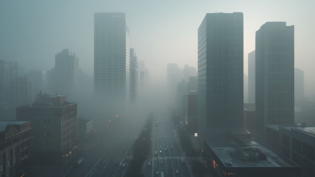
Dense Fog Conditions in Northern Plains
Eleven districts in Madhya Pradesh had temperatures below 10 degrees Celsius. The coldest city was Umaria, when temperatures fell as low as 7 degrees Celsius. Jabalpur recorded 10.8 degrees Celsius and Ujjain 13 degrees, while Bhopal, Indore, and Gwalior reported minimum temperatures of 11 degrees Celsius.
🌫️ Dense Fog & Visibility Alert
- Worst Affected State: Uttar Pradesh
- Lowest Visibility: 80 meters in Bahraich
- Bihar Impact: Zero visibility in Gopalganj
- Travel Risk: Road, rail, and air services affected
- Public Advisory: Avoid early morning travel
Cold Wave Grips Madhya Pradesh
On February 9, the Meteorological Department forecasted snowfall in the upper regions of Himachal Pradesh and Uttarakhand. On February 10, both states should have rain and snow.
Snowfall and Rain Forecast in Hill States
❄️ Snowfall & Western Disturbance Update
- System: Fresh Western Disturbance
- Start Time: Night of February 9
- Regions: Himachal Pradesh & Uttarakhand
- Impact: Snowfall in higher elevations
- Plains: Gradual reduction in fog
Day-wise Weather Outlook
February 8: Delhi, Uttar Pradesh, and Madhya Pradesh may have heavy fog in the morning, while the higher Himachal Pradesh regions are likely to get light snowfall or rain.
February 9: Himachal Pradesh will see a new Western Disturbance starting tonight. There may be less fog in the plains in the morning, and there may be snowfall in the higher regions.
Frequently Asked Questions
1. In Uttar Pradesh and Bihar, which regions are most impacted by heavy fog?
In Uttar Pradesh, there was heavy fog in over ten districts, with Bahraich having the lowest visibility at 80 meters. Gopalganj reported no visibility in Bihar, and Madhubani reported heavy fog.
2. How much did Madhya Pradesh’s temperatures drop?
Eleven Madhya Pradesh districts saw temperatures below 10°C. Cities like Bhopal and Indore had temperatures of about 11°C, while Umaria had the lowest temperature at 7°C.
3. What kind of weather can we expect in Himachal Pradesh and Uttarakhand?
The Meteorological Department has predicted that snow would begin to fall in the higher regions of Himachal Pradesh and Uttarakhand on February 9 and that rain and snow will fall on February 10.
4. How does thick fog affect day-to-day living?
Heavy fog has made it much harder to see, which has an impact on air, train, and road travel. Visibility fell below 100 meters in certain places, raising the possibility of delays and accidents.
5. How will the Western Disturbance affect things?
Beginning on the evening of February 9, a fresh Western Disturbance will be active in Himachal Pradesh, causing snowfall in higher elevations. The plains may see a minor decrease in fog in the morning.
Conclusion
With low temperatures engulfing Madhya Pradesh, heavy fog impairing visibility in Uttar Pradesh and Bihar, and more snowfall predicted in Uttarakhand and Himachal Pradesh, North India is still experiencing harsh winter weather.
While some plains will gradually see less fog, hilly areas will likely see more intense weather activity as a new Western Disturbance moves in. It is recommended that locals and visitors exercise caution and pay close attention to weather reports.
Disclaimer: This article is based on official weather forecasts and reports. Weather conditions may change. Readers are advised to follow local authority updates.